
We offer a comprehensive and continuous dataset to give you unique insights across multiple industries.
Insight
Our integrated data insights can be viewed and continually assessed with our software platform, Russell ALPS.
Analysis
Our expert consultants can take a customised and commercialised approach to problem-solving to suit your interests or situation.
Action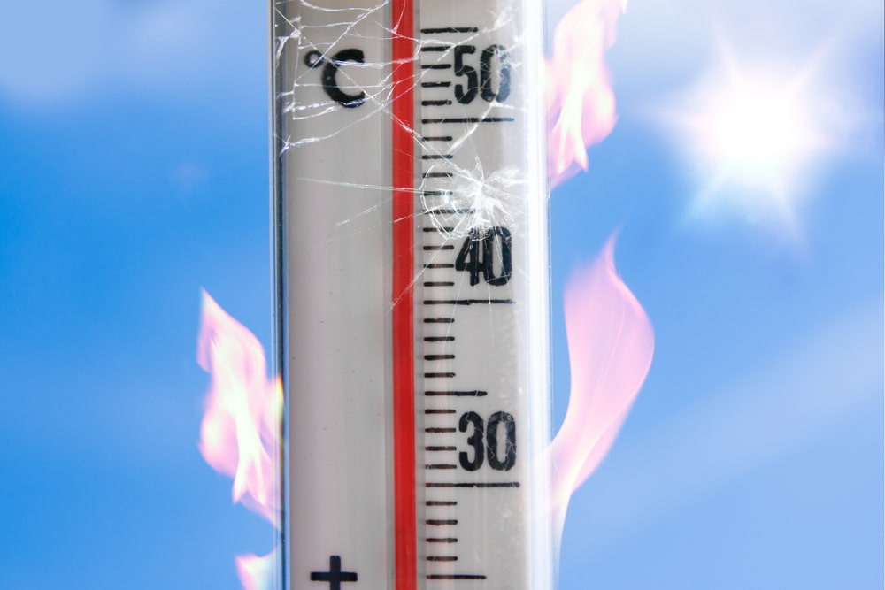
Chis Don sat down with James Banasik, Head of Connected Risk, to discuss the extraordinary weather we are currently experiencing:
Q: A cursory glance at the news will tell you that large parts of the planet have been experiencing unusual weather conditions. What on earth is going on?
A: The Atlantic heat anomaly is creating an atypical circulation. Typically an El Niño development (a warm water anomaly across the Tropical Pacific) matches or at least becomes the driving force globally - its circulation inhibits other typical circulations.
Q: So we are entering a new El Niño?
A: On the face of it, we are into El Niño conditions, notably across the East Pacific. In order for strong (globally impactful) El Niños to form, however, the oceanic anomalies need to connect with the atmosphere and imprint themselves upon the atmospheric circulation. So far in 2023, we have not seen this happen strongly nor consistently.
Q: Why is that?
A: This may be due to the marine heatwave in the Atlantic creating an opposing driving force, which means that the atmosphere across the Pacific has/will be interrupted from ‘connecting’ with the Ocean – an outcome it is trying its hardest to effect.
Q: What might the impacts be?
A: The next few weeks will be critical for the El Niño’s development and therefore its impacts, which typically lessen the number of and/or strength of Atlantic storms. Should this development continue to be interrupted, however, we could end up with a supercharged Hurricane season (in terms of their development across the Atlantic) and an increasingly more hospitable environment for these storms to head West uninterrupted towards the US coastline and with time, into the Gulf of Mexico.
Q: So, at this stage, we are unsure as to whether there will be weak hurricane season (and hence, a good year for underwriters), or whether there will be a hurricane season spectacular (and hence a very bad year for underwriters?
A: Yes. With what we know about the Ocean temperatures and their ability to hold onto heat – we could be seeing an unusually prolonged Hurricane season. With enough water warm (above 26.5 degrees Celsius) sustaining these temperatures into November even into December, with some areas on the Gulf Of Mexico approach record breaking temperatures, the recipe for potential for disruption/impact and ultimately cost could be starting to come together. This in a year which was supposed to be ‘quiet’ generally, as dominated by a traditional understanding of a developing El Niño.
Q: Is there some sort of trigger which could ignite a hurricane season and up end conventional understanding of El Niño outcomes?
A: Usually, the Atlantic storm season needs a spark, usually driven by or at least linked to intensive rainfall activity circulation around the globe, which recently has been quiet (weak) but will likely become stronger if the El Niño circulation does not start to dominate. This again – as with lots of patterns in weather – is another feedback loop. If it begins it could precipitate a chain of events (very difficult to stop) resulting in not just an above average Atlantic storm season but perhaps a more prolonged as well.
Q: And the alternative is?
A: As ever with weather, if we see the opposite and the El Niño starts to develop more strongly and link-up with the atmosphere then the storm season might not get off the ground at all (with respect to US landfall). What is becoming clearer is that as the climate is changing it is becoming increasingly less predictable - at times – and one year becoming much less like the next. So to assume we know what will happen next because it happened before is becoming less useful and with time; perhaps dangerous.
Q: What is the underlying context for this new either/or weather paradigm? Can we get into the nuts and bolts of these weather change drivers?
A: The unusually warm Spring in Greenland, which resulted in much less/thinner snow cover has created a feedback loop (one event which triggers another) that has dominated and driven weather patterns for the start of the North Hemisphere summer. This has been driven by a lack of heat reflection (due to the surface colour [white] of the snow/ice) caused by below average snow cover/depth across Greenland. This lack of cover caused an unusually persistent high pressure system (block) to form to the south of that region effectively locking in the pronounced ‘wave’ pattern in the Jet Stream.
Combined with the changing climate (tendency to see more frequent and longer ‘warm’ periods) this has resulted in an anomalously large and strong area or area(s) of above average temperatures and below average rainfall across the Northern Hemisphere.
Q: Is this the so-called ‘heat dome’ effect?
A: Heat centres (or domes) have dominated weather patterns in three areas across the North Hemisphere.
Firstly North Western China (start of June), then South Western USA (mid-June) and most recently at the end of June across the Southern Mediterranean, the first of which has weakened with temperatures across Northern China waning – albeit still above average.
In Phoenix, Arizona temperatures of up to 46 degrees have been forecast and follows a record-breaking three weeks in a row of highs above 43C (110F). The ongoing heat wave in Phoenix has been the most intense one the city has experienced since records began in 1895. The Valley of the Sun has sweltered under temperatures of 43C or higher for 23 consecutive days and counting. The old record streak of 18 days at or above a high temperature of 110 degrees, set in 1974, was broken Tuesday, July 18, when temperatures met the benchmark around noon.
The SW USA heat dome looks to be breaking down as we approach the end of July and the Heat in the Mediterranean likely to last a little longer into early August. Even with some of the breakdowns in sight, these events have broken records not just for daily temperature maxima across large areas but notably the duration of these events.
Q: Is this what we mean by connected risk in a weather context?
A: In some areas across Europe especially where vegetation is more widespread than, say, the desert in the US, wildfires are hitting the headlines – not just an impact upon land/business in the vicinity but also having a profound impact upon tourism, perhaps on a larger scale with flights to some areas of the Mediterranean down by 10% for this August compared to last. According to CNN the European Travel Commission, a Brussels-based association of European tourism organizations, said that the number of European tourists planning to travel to Mediterranean destinations in the summer and Autumn has dropped 10% compared with the same period last year.
As the locked in pattern finally breaks down, the impacts of both above average land/sea temps will result in a super charged severe weather outbreak along a supercharged jet stream. As the lid comes off the heat - so to speak - across the southern Med. it will try to spread northwards.
Q: Phew, it is a lot to take in. Who knew that weather could be so complex? Is there anything else that underwriters need to be aware of?
A: There is a third scenario whereby the ocean waters across the West Pacific remain 1 to 1.5 degrees above average. This creates the breeding ground conditions for storms which will likely sustain their strong winds further north as the summer heat continues across Japan, but the atmosphere does not go strongly into its El Nino circulation. This has a lessened impact upon Atlantic storm formation, or rather its prevention of storm tracks into the Gulf.
Q: OK, what might that mean for weather-conscious underwriters?
A: This half-way house scenario could be the worst case for Underwriters as both oceans will have hospitable, possibly even favourable, conditions across the Pacific for storms, this summer. This is strongly suggested by the formation of a Typhoon, recently upgraded to Super Typhoon ‘Doksuri,’ tracking to the north of the Philippines with 130-140mph winds, expecting to continue NE towards Taiwan. It will pass to its West but is still likely to cause 100mph+ winds across the South of the Country, already the 2nd Typhoon in this area in 2023.
Q: What should business do?
A: We should prepare for some unusually severe/ perhaps tropical weather events (sudden downpours and damaging wind events) driven by increased heat/energy… but this might not be the most profound impact of this current weather pattern for 2023. The land can warm/cool the air above quite quickly (as it itself loses/gains heat), and temperatures can change by 10’s of a degree in one hour - the ocean however warms and cools down much slower. There are Business Interruption implications therefore for manufacturers, logistics operators, airports, ship ports, energy providers and many other types of firms.
Russell with be watching for developments across the Pacific and their impacts globally, but most notably upon the Atlantic storm season as it heads towards its climatological peak in end August/September…

